Chão da Ribeira
Beautiful valley covered by Laurisilva forest. Access by the Town. Near the Church, to the left, when you come to a crossroads turn left again, and go all the way up the mentioned place.
Beautiful valley covered by Laurisilva forest. Access by the Town. Near the Church, to the left, when you come to a crossroads turn left again, and go all the way up the mentioned place.
Queimadas are an isolated place, 5 km south of Santana, where you can go for a picnic or a walk. To the west of Santana, you can turn into a secondary road, quickly leading into rough pathway that goes up the mountain. After passing bundles of furze, hydrangeas and wild flowers, this pathway leads into […]
Pico das Pedras is situated in the civil parish of Santana. In this beautiful place you can see many indegenous plants and trees of Madeira Island. This is a nice starting point for one of the most beautiful levadas of Madeira. This evada/walking path is Pico das Pedras – Queimadas – Vale da Lapa – […]
The Balcões viewpoint is at São Roque do Faial parish. This viewpoint, when the weather permits, enables a fantastic view above the green mountains where we can see Eagle Rock (Penha d`águia) site. Is an amazing viewpoint above the very own view in north of Madeira Island.
The Ribeiro Frio viewpoint is at São Roque do Faial parish. This is a space between the green mountains at Madeira Island that permit to the visitant relaxant moments in the middle of nature. The nature is constant!
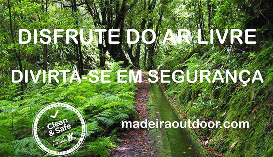
This park covers 1,000 hectares and rises to 1800 m above sea level. The lowest section of the park is only 520 m above sea level. The park was conceived as an educational and conservation resource, but also to provide additional leisure space for the population and for visitors. Because of the significant variation […]
Start: Pico Ruivo Shelter Finish: Encumeada Time: 6h Distance: 11,2 km Starting at Achada do Teixeira and following along PR 1.2- Pico Ruivo Footpath leading to the Pico Ruivo Shelter, you will find signs indicating the following routes: PR 1- Pico do Areeiro Footpath, leading to Madeira’s 2nd highest peak (1817m); and PR 1.1- Ilha […]
Start: Achada do Teixeira Finish: Achada do Teixeira Time: 1h30 Distance: 5,6 km Beginning at Achada do Teixeira this trail climbs up to the island’s highest peak, Pico Ruivo (1861m). Next to the Pico Ruivo government house you can gain access to 3 other trails that take the hiker to different parts of the island: […]
Start: Pico do Areeiro Finish: Pico Ruivo Time: 3h 30m Distance: 7 Km / 5.6 Km This trail is unique in that it links the two highest peaks of Madeira Island, Pico Ruivo (1861 m) and Pico do Areeiro (1817 m), traversing part of the Central Mountain Massif, an area integrated in the Natura […]
Start: Pico Ruivo Finish: freguesia da Ilha ou Achada do Marques Time: 3h Distance: 8,2 km This trail incorporates a drop of 1376 metres, and the climb up or down should be done slowly, taking in the landscape. Starting at the Pico Ruivo government house, and after climbing up to the mountain’s highest peak, following […]
Start: E.R. 109 (Baía d’ Abra) Finish: E.R. 109 (Baía d’ Abra) Time: 2h 30m Distance: 4 Km (+ 4 Km return) The trail follows S. Lourenço Point, the eastern-most peninsula of Madeira island, so named after the caravel sailed by João Gonçalves de Zarco, being one of the three discoverers of Madeira […]
Start: Ribeira da Cruz (E.R.101) Finish: Junqueira (Tornadouro) Time: 3h 30m Distance: 10,3 Km This trail begins at the E.R.101 regional road, at the Ribeira da Cruz River, which separates the Porto Moniz Municipal area from the Calheta Municipal area. Walking in the opposite direction to the waterflow you can visit one of the springs that […]
Start: E.R. 103 (Ribeiro Frio) Finish: E.R. 102 (Portela) Time: 5h Distance: 11Km This trail begins at Ribeiro Frio in the municipality of Santana and follows the pathway accompanying the Levada of Serra do Faial at an elevation of 860 metres up to the station where the waters divide. Descending from there to the area […]
Start: E. R. 110 / Rabaçal Finish: E. R. 110 Time: 3h Distance: 4,6 Km (+ 4,6 Km return) Both trails begin on the regional road (E.R. 110), and go down as far as the Rabaçal government house. The trails diverge along two parallel levadas located on different levels. Trail PR 6.1, goes along Levada […]
Start: Portela Finish: Maroços Time: 3h Distance: 8,7 km This trail begins at the Portela viewpoint, from where we have a magnificent view over both the Porto da Cruz and Faial parishes which is dominated by the rocky outcrop of Penha d’Águia. The hike begins along the forest road of the Funduras mountain range, and […]
Start: Queimadas Forestry Park Finish: Queimadas Forestry Park Time: 5h 30m Distance: 6.5 Km (+6.5 Km return) This trail begins at the Queimadas Forestry Park and winds along the walkway of the levada of Caldeirão Verde at an elevation of 990m, in the municipality of Santana. The levada of Caldeirão Verde is an impressive work […]
Start: Ginjas – S. Vicente Finish: Ginjas – S. Vicente Time: 3h 30m Distance: 3,9Km (3,9Km return) This trail begins at Ginjas in the municipality of São Vicente and follows the walkway alongside the Fajã do Rodrigues levada or the Fajã da Ama Levada, both being the names used for this levada, it ends at the […]
Start: Boca da Corrida Belvedere Finish: E.R. 228 (Encumeada) Time: 6h 30m Distance: 12.5Km This trail begins at the Boca da Corrida belvedere and meanders along at elevations ranging between 940 and 1340 metres, whilst crossing part of the Central Mountainous Massif along the foot of the highest peaks of the island of Madeira. It […]
Start: E.R. 209 (Fanal) Finish: E.R. 209 (Curral Falso) Time: 3h Distance: 5.8Km This trail begins at Regional Highway E.R. 209 next to the well-known area of Fanal on the Paúl da Serra plateau and follows the Cedros Levada until it reaches the parish of Ribeira da Janela. Take advantage of the magnificent area of Fanal, a […]
Start: E.R.209 (Curral Falso) Finish: Ribeira da Janela Time: 1h 30m Distance: 2.7Km This route links the settlement of Ribeira da Janela and the forested area above it, ranging at altitudes between 400 & 820 metres. It begins at regional highway 209, in the area of Curral Falso, and ends at the same highway in […]